 Filter: Categories of Wisconsin Historical Images
Filter: FORMAT_DIMENSIONS of 31 x 31 cm.
Filter: Categories of Wisconsin Historical Images
Filter: FORMAT_DIMENSIONS of 31 x 31 cm.
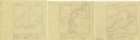
| Date: | 1939 |
|---|---|
| Description: | A survey map of Island Lake in Bayfield County, Wisconsin, Chain Lake in Rusk and Chippewa counties, and Manson Lake in Oneida County. The maps show the de... |

| Date: | 07 02 1836 |
|---|---|
| Description: | An ink on paper, hand-drawn map shows the sections and streams in Township 5, Range 1 east, which covers parts of the present-day towns of Mifflin and Lind... |

| Date: | 1836 |
|---|---|
| Description: | An ink on paper, hand-drawn map of the survey of the (Township No. 8, Range No. 16 East of the 4 Meridian) Town of Ixonia, Jefferson County, Wisconsin incl... |

| Date: | 07 1868 |
|---|---|
| Description: | A hand-drawn map of a portion of Jackson County, Wisconsin between Township No. 21 north, range number 4 West and township no. 21 north, range no. 3 west, ... |

| Date: | 1935 |
|---|---|
| Description: | Two hand-colored maps of the area comprising the town of Millston (Plats of Townships 20 and 21 north, range 2 west), Jackson County, Wisconsin, showing 40... |
| Date: | 1955 |
|---|---|
| Description: | These 24 plat maps of the Town of Newton, Manitowoc County, Wisconsin, show soil type; mortgages in force as of January 1, 1932; land warrants holders; mor... |

| Date: | 1800 |
|---|---|
| Description: | This 19th-century manuscript map of the Town of Newton, Manitowoc County, Wisconsin, shows sections, lakes and streams, the trail from Chicago to Green Bay... |

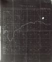
| Date: | 1890 |
|---|---|
| Description: | These hand-colored maps show the sections, lakes, swamps, streams, and state, vacant, entered, and withdrawn lands in ten survey townships in Oneida, Vilas... |

| Date: | 1930 |
|---|---|
| Description: | These 40 hand-drawn maps depict the survey townships in Oneida County, Wisconsin, on printed township grids. Lakes, rivers, and waterfront properties are d... |

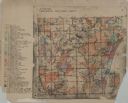
| Date: | 1898 |
|---|---|
| Description: | This 1898 map of Outagamie County, Wisconsin, shows the township and range grid, towns, sections, cities and villages, the Oneida Reservation, landownershi... |

| Date: | |
|---|---|
| Description: | This 19th century manuscript map shows the southeastern portion of the Town of Stephenson in Marinette County, Wisconsin. Sections, lakes, and streams are ... |

| Date: | 1840 |
|---|---|
| Description: | This manuscript map is ink, pencil, and watercolor on paper and shows landownership. An approximate date can be established by the names written on the pla... |

| Date: | 1962 |
|---|---|
| Description: | This blue print map shows 5 zoning districts, as well as lot and block numbers and dimensions, public land, streets, and Mill Pond. The zones are: "Single ... |
| Date: | 1900 |
|---|---|
| Description: | This map shows land purchased by Solomon Juneau on Sept. 29, 1847, according to U.S. Land Office, local office tract books, Wisconsin, volume 70. Juneauvil... |

| Date: | 1943 |
|---|---|
| Description: | This map shows roads, trails, taverns, schools, golf, gas stations, campsites, resorts, and towers. The lower left of the map includes a legend. The map co... |
If you didn't find the material you searched for, our Library Reference Staff can help.
Call our reference desk at 608-264-6535 or email us at: